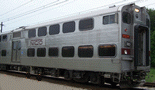
The Second Public Meeting

Something happened since September when eight plans were presented to the public, and it isn’t good.

“Option 1″ detailing a path running south of the houses along 10th St and along the south edge of 11th St through Michigan City has been changed. The new version of “Option 1″ places the tracks in the current 66ft right of way through town with minor changes where the line crosses Amtrak and on the curve west of Michigan Blvd. This change makes “Option 1″ less attractive. Instead of buying a line of houses through the city, compensating the owners, the new “Option 1″ places a line in their front yards – removing street access to 11th St for all the properties on the south side. Residents would be better off having their houses taken at below market value than having their houses left intact with no street access. The new “Option 1″ also affects properties on the north side of the street … removing 15ft of land between the current curb and right of way line and creating a one lane “street”.

The worst part about the new “Option 1″ is that it is not presented as “Option 1A” … it has taken the place of Option 1 as the planning moves forward. While there are five northern options left on the table (Options 3, 4, 5, 6 and a combination 6-3) the original Option 1 has been lost. Not to mention that the goal of removing the tracks from 11th St is not met by leaving the tracks in 11th St – and destroying the street. The original “Option 1″ needs to be restored and considered along side other options.

The original Option 1 can be seen here in a previous post.

Changes in the Options
As the planners moved from the eight options presented in September to the seven options currently in play the following changes were made.
Option 1 – 11th St – moved from the south side of 11th St back into 11th St as discussed above.
Option 2 – CSX Route – Survived intact.
Option 3/3A – Northern route staying west of Trail Creek – Adjusted to go under the US 12 bridge. Option 3 along Trail Creek to the Nickle Plate is now gone with 3A becoming the new Option 3.
Option 4 – Northern ground route with lift bridge – Survived intact.
Option 5 – Northern elevated route – Survived intact.
Option 6 – Northern ground route along Michigan Blvd, rerouting US 12, with low level Trail Creek bridges – Survived intact.
Option 7 – Northern ground route along Michigan Blvd, rerouting US 12 and Amtrak, with low level Trail Creek bridges – removed as an option.
Option 3 and 6 – Combined option following Option 6 down Michigan Blvd then curving south along Option 3 alignment to current NICTD alignment.

Decision Time
The next step is for eight people, four from the city and four from NICTD, to make the final determination between the routes. Public comment is still being accepted through the project website but there will be no more public meetings until the decision is presented to the public.

Media Reports:
Residents give input on rail realignment
Story at The News Dispatch (February 24th)

Officials: South Shore plan’s hefty costs won’t burden city
Story at The News Dispatch (February 2nd)

The First Public Meeting

My Summary of the Options Presented
Option 1: This follows the existing South Shore corridor. While this option calls for the removal of every home and business on the south side of 11th St and some homes at the west end of 10th St and south of 10th St by the prison, this is the most direct route through town. Some streets would need to be closed along 11th St but the major streets would remain open.

Option 2: This follows the CSX corridor to the south. This option would avoid disturbing homes in the 11th St corridor or elsewhere in northern Michigan City. The rejoin point is east of the current car storage and maintenance yard which would require a new yard to be built to the east of Michigan City.

Option 3 through 7: These are the northern options. All of the northern options run between the NIPSCO plant and US 12 on the north side of Michigan City. All except 3A run down the former Nickle Plate Corridor. Options 4 through 7 pass though an area that was historically a rail corridor but is now a nature park. All of the northern options would lead to disruptions with homes along US 12 west of downtown and businesses in the waterfront area.

Option 3 and 3A: These options run west of Trail Creek. While this avoids crossing Trail Creek and the issues of building a crossing acceptable to the Coast Guard, this alignment would place the tracks between Michigan Avenue and the marina and the plan calls for a station near the marina with bridges connecting the station to the Blue Chip Casino. These changes would interfere with the operation of the marina.

Option 4: This crosses Trail Creek at a proposed moveable bridge and uses the full Nickle Plate Line right of way from US 12 to the existing shops.

Option 5: This crosses northern Michigan City on an elevated alignment high enough to clear boats on Trail Creek (the same height as the US 12 bridge but across the entire Michigan City skyline). It would provide a good view of the lake from the train line but would provide a wall north of US 12.

Options 6 and 7: These crosses Trail Creek on a low bridge (requiring Coast Guard permission to close the marina to tall mast boats). Both call for the relocation of US 12 to the north of the current alignment with option 7 also calling for the relocation of the Amtrak tracks and station. This would provide the best view from US 12 of Lake Michigan but would disrupt city buildings and businesses north of the current US 12. Option 7 would disrupt everything north of US 12 and south of Trail Creek.

Proposed Stations
The location of the proposed new combined station for NICTD would vary depending on the route chosen.

Option 1 would place a single station downtown with parking south of the tracks. Passengers who currently board at the old Carroll Ave station would have to find the new downtown station … which would increase traffic on 11th St and Franklin St.

Option 2 would place a single station near the intersection with Franklin St. There is no direct route from the east to this station. Traffic would increase on Franklin St.

Option 3 and 3A would place a single station at the marina south of US 12. This is a decent location for a commuter station with easy access from Michigan Ave and close access from US 12.

Option 4 would place a single station north of the Blue Chip Casino which would also serve passengers arriving on US 12 or Michigan Ave.

Options 5, 6 and 7 place a single station in the current city hall/police station area. This also would be an easy place for commuters in cars to access.

In all cases sufficient property would need to be purchased to replace all existing parking at 11th St and Carroll Ave (including the overflow lot and street parking) as well as handle any increase in demand for parking.

Media Report:
Large crowd turns out for South Shore open house
Story at The News Dispatch

OFFICIAL SITE AVAILABLE

The official site for the “Michigan City Alternative Analysis Realignment Study” is available.

http://emichigancity.com/cityhall/departments/planning/alternative-analysis/

Bids sought for NICTD study

From The News Dispatch:

The Northern Indiana Commuter Transportation District has started reaching out to consultants to begin a $1 million study of potential South Shore Line routes.

NICTD spokesman John Parsons said Thursday he hopes NICTD and the city will have a consultant selected by the end of March to study four routes through town.
. . .
According to the scope of services described in the request for proposals, the city and NICTD want the study to result in a recommended, preferred alignment.

The study will consider four routes: two northerly routes, a new 10th-and-11th Street route and a southerly route.
. . .
The request for proposals states consultants should be able to deliver: a description of each alternative, a report evaluating the alternatives, an alternative analysis report that includes a preferred alignment, a document identifying next steps for the project and descriptions of public outreach.

Running Out of Time to Fund the Study

The News Dispatch Reports:

Funding dire for South Shore study

Published: Thursday, March 25, 2010 4:16 AM CDT

MICHIGAN CITY — Down to their “last hope” for $2 million to fund a preliminary engineering study of all possible configurations relocating the South Shore Line through Michigan City, South Shore and city officials said Wednesday they likely will need to pursue other options.

Any modifications to the South Shore Line may now be pushed back later than 2015 if funding isn’t found by the end of next month, requiring the Northern Indiana Commuter Transportation District to file for an extension of time.

It is time to get going. Five years is not a long time to get this done.